|
This page was refreshed |
Weather & River Gage page for Sny Island Levee Operations Page automatically refreshed every few minutes, map updated 2-4 minutes during severe weather. |
||||||||||
Information from
National Weather Service
|
|||||||||||
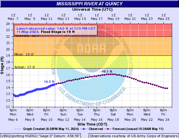
Quincy
Hannibal 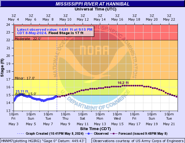
Saverton 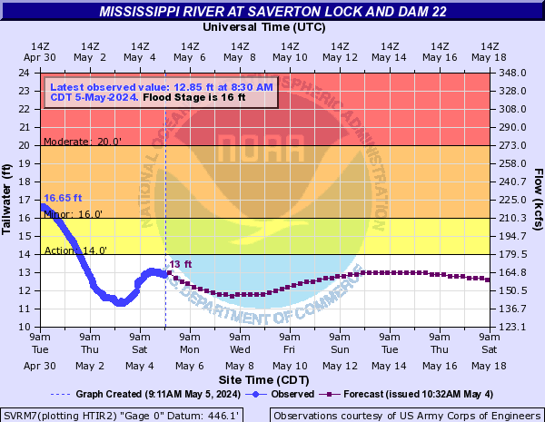

Louisiana 
Clarksville 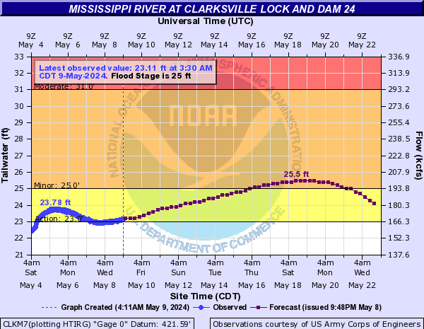
|
|||||||||||
|
Click Here to open the USACoE-StL River Stage Forecast in a new window Meredosia 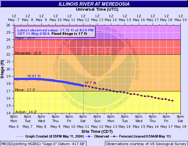
Valley City 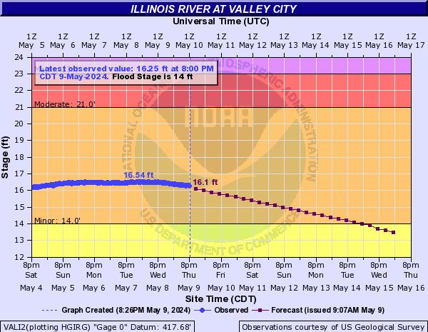
Hardin 
|
|||||||||||
|
Weather Radar Mapping from
Weather Underground
|
|||||||||||
|
Sny Basin Radar
|
|||||||||||
Arrows on the maps show 60-minute projected storm center paths.
|
|
Regional Radar
|
Rainfall amounts based on Radar
|
National Forecast Map 
|
|
Surface Winds | ||||||